|  |
|
||||||||||
|
Megalithic geometry: an overview
Many thanks to
Little Sawyer for posting me this article
Megalithic geometry (also called 366-degree geometry) is the name given to an hypothetical geometry supposedly used and perhaps created by an alleged Megalithic civilization of Britain and Britanny, France, according to certain British authors Alan Butler1 and Christopher Knight, and French author Sylvain Tristan. This geometry, whose origin is claimed to go back to c.3000 BC, would have used a 366-degree circle rather than a 360-degree circle as we do today. Megalithic geometry according to Alexander Thom
One of the first persons to associate Megalith builders with geometry was Scottish Professor Alexander Thom (1894–1985). Although he never hypothesised any 366-degree geometry himself, he strongly suspected the Megalith builders had great astronomical and geometrical knowledge that they used when building the stone rings of Britain: “geometrical shapes [were] used for the rings, i.e. circles, flattened circles, egg shapes, ellipses, and other more complicated designs.”2 According to him, these stone arrangements had astronomical alignments, and they used Pythagorean triangles and “geometrical figures which had as many dimensions as possible arranged to be integral multiples of their unit of length.”3 After several decades of research Thom arrived at the conclusion that the Megalithic builders used a standard unit of measurement which he dubbed the Megalithic Yard. According to him, the length of this unit was 2.72 Imperial feet or 82.96 cm.4 A geometry linked to the Earth's circumference?
According to Alan Butler this geometry was based on the Earth's polar circumference. The Megalithic degree is the 366th part of it, i.e. 40,008 / 366 = 109.31 km; the Megalithic arcminute is the 60th part of the Megalithic degree, i. e. 109.31 / 60 = 1.82 km; the Megalithic arcsecond is the 6th part of the Megalithic minute, i.e. 1.82 / 6 = 0.3036 km; if this Megalithic arcsecond is in turn divided into 366 equal segments, the length arrived at is 0.8296 m, which is the presumed length of the Megalithic Yard, the supposedly ancient unit of measurement independently discovered by professor Alexander Thom in the 1950’s. This is precisely this apparent coincidence that prompted Butler to think that the Megalith builders could have been cognizant with an Earth-based 366-degree geometry. A 366-day calendar?
According to Butler, 366-degree geometry is linked to the Phaistos Disc, an earthen artifact discovered in Crete in 1908, which could have been a Minoan calendar based on a 366-day year, the Phaistos Disc having 30 divisions on one side and 31 on the other: indeed, a calendar alternating 30-day months and 31-day months would result in a 366-day year. This calendar would have been working on 40-year cycles, because a 366-day calendar gets exactly one month late in 40 years. Thom had also hypothesized that the Megalithic Yard was divided into 40 Megalithic inches,5 a number that indirectly echoes the 40-year cycles of the presumed Minoan calendar in ancient Crete. Butler also noticed that the division of the same Megalithic arcsecond into 1000 equal parts yielded a length of 30.36 cm, which is curiously that of the Minoan foot, a unit of length used in the Cretan palaces built roughly at the same time as the Phaistos Disc was made, and independently discovered by Canadian archaeologist J. Walter Graham. A Megalithic pendulum?
In another book coauthored with English writer Christopher Knight6 Butler wrote that the length of a pendulum giving 366 beats (or 183 periods) during one 366th of a day (which is approximately the time it takes to the Earth to spin one Megalithic degree) is one half-Megalithic Yard long. From that the authors suggested that such a pendulum could well have been used by these ancestral people to accurately reproduce the length of their yard. Such a pendulum has never been discovered to this day. It should be noted, however, that in a book coauthored with Robert Lomas in 20017 in which the question of the Megalithic pendulum is discussed, Christopher Knight mentions the existence of what he calls ‘stone things’ (these are normally referred to as ‘carved stone balls’) from the Neolithic that have been found in numerous places of Scotland (more particularly in Skara Brae, cited by French author Sylvain Tristan as being located along the 60th Megalithic parallel -- see the section ‘Salt Lines’ below) and whose meaning is unclear, but that could have been pendulum weights. Volumes and masses
In the book Civilization One, Butler and Knight contend that the basic units of volume and mass of the imperial system, the imperial pint and the avoirdupois pound, are also derived from the Megalithic Yard. Just like the litre is the tenth part of the metre to the cubic power, the tenth part of the Megalithic Yard to the cubic power produces a volume of ( 82.96 cm / 10 ) third power = 570.96 mL, a very close approximation of the modern pint of 568.26 mL. Similarly, this theoretical Megalithic pint, if filled with barley dry seeds, weighs on average a number close to 453.59 grams, which is the exact value of the avoirdupois pound. Stranger still, the division of the Earth mass into 366 equal parts, then again into 60 equal parts, and then again into 6 equal parts, yields a result that is almost exactly 10 to the 20th avoirdupois pounds : 5.9736 X ( 10 to the 24th ) kg / ( 366 X 60 X 6 ) = 4.5337 X ( 10 to the 19th ) kg = 9.995 X (10 to the 20th) avoirdupois pounds. Said differently, a one-Megalithic-arcsecond-thick ‘slice’ of Earth (at the equator) weighs almost exactly 10 to the 20th pounds, as though, according to the authors, the exact value of the pound had been adjusted so as to be a round subdivision of a one-arcsecond-thick slice of Earth in the Megalithic geometry. Are 366, 40 and 10 fundamental numbers ?
Still in the same book, Butler and Knight claim that the Megalithic Yard is a fundamental number for the Sun, the Moon and the Earth. The Megalithic arc second as measured on the Earth equator is very close to 366 Megalithic Yards, while the lunar Megalithic arc second as measured on the Moon equator is very close to 100 Megalithic Yards, and the solar Megalithic arc second as measured on the Sun equator is very close to 40,000 Megalithic Yards. In a book published in France and Canada in 20078 French author Sylvain Tristan suggests that the numbers 366, 40 and 10 are not only fundamental to the Earth, the Moon and the Sun, but also to the human body and to water. In the water-based Celsius temperature measurement system, which is directly linked to base-10 numeration, the average human body temperature is 36.6 degrees (according to Russian medicine9), whereas the optimal temperature of water (its maximal density) is 4.0 degrees. Salt Lines Alan Butler also asserts that 366-degree geometry has been materialised on the Earth by what he terms Salt Lines – 366 meridians and 183 parallels crisscrossing the globe at regular intervals (the equivalents of modern-day 360 meridians and 180 parallels). The term Salt Line was created by Xavier Guichard,10 who was the first person to posit the existence of such lines in the 1920’s and 1930’s. After having looked at a map of France, Guichard had noticed a recurrent name which he linked to Alesia, the place where Julius Caesar defeated Gaulish leader Vercingetorix in 52 BC. At the time, Guichard thought the Bronze Age people had invented the 360-degree circle. But because the intervals between the lines were seemingly too small, nobody took him seriously at the time. It was only in the late 1990’s that someone (namely Alan Butler) had a second look on Guichard’s tentative hypothesis.
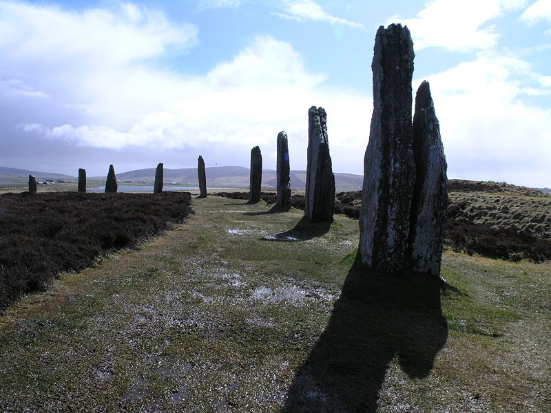
Butler explains the smaller intervals between the lines by the fact that in a 366-degree circle, you get a few more lines than in a 360-degree circle, which of course entails a slight decrease of the interval between two lines. According to Sylvain Tristan,11 most of the world’s capital cities or sanctuaries of late prehistory and antiquity are located on the course of Salt Lines: it includes Stonehenge, Avebury, the Ring of Brodgar and Skara Brae (both of which are located on the 60th Megalithic parallel), Babylon, Assur, Niniveh, Thebes, Abu Simbel, Harappa, Mycenae, Athenes, Hattusa, Alesia, Teotihuacan (20th Megalithic parallel), Chichén Itzá, Tiwanaku and Caral. According to the author, such a situation challenges probability laws and can hardly been explained away by chance only, and thus is the result of some common knowledge held by the Megalithic civilisation that might have spread to different parts of the globe. Tristan also thinks that the Salt Lines Prime Meridian could have been the Jordan River, a river that approximately flows in a north-south direction and along which numerous Megalithic sites from the 4th millennium BC are to be found. Although no solid link has ever been established between Megalithic sites of the Middle East and those of Europe, the Megalithic people are known to have been sailors.12 It is also known that the first phase of Stonehenge dates from c.3100 BC. Tristan claims that Stonehenge was positioned so as the number of degrees between the monument and the prime meridian be an integer. Tristan also claims that the lost city of Alesia is not located in the village of Alise-Sainte-Reine as mainstream scholars contend, but on the double hill of the Montfault and the Glass Mountain near the village of Guillon in Burgundy. This location was first suggested by Bernard Fèvre in 1982.13 The hills are located on the course of a Salt Line and stand halfway between the cities of Aalst, Belgium and Alès, southern France, two cities whose name sound like Alesia and which are located along the same meridian. See also * http://www.civilizationone.com/reviews.html (includes a review of Civilization One from the British Association of Teachers of Mathematics) * http://www.world-mysteries.com/gw_cknight.htm (extracts from a review of Civilization One by Colin Wilson in the London Daily Mail)
4.
article from The Times, 11
September 2004: http://entertainment.timesonline.co.uk/tol/arts_and_entertainment/article480497.ece
5.
Thom, Alexander, and A.S. Thom. Megalithic
Remains in Britain and Britanny. Oxford:
Clarendon Press, 1978
6. Butler, Alan and Christopher Knight.
Civilization One: Uncovering the
Super-science of Prehistory: The World Is Not as You Thought It Was.
London : Watkins, 2004. ISBN-10: 1842930958 and ISBN-13:
978-1842930953
7. Lomas, Robert and Christopher Knight.
Uriel's Machine: Uncovering the Secrets
of Stonehenge, Noah's Flood and the Dawn of Civilization.
London: Fair Winds Press, 2001. ISBN-10: 193141274X
8.
Tristan, Sylvain. Atlantide, premier empire européen.
Paris : Alphée, 2007. ISBN-10: 2753802106
and ISBN-13: 978-2753802100
9. http://www.366.ru/ (website of the Russian
pharmacy chain "36.6" that takes its name from what is
considered in Russia to be the average human body temperature)
11.
Tristan, Sylvain. Les Lignes d'or. Pourquoi TOUTES les capitales
des premières grandes civilisations furent erigées sur
ces axes. 2005. Paris: Alphée. ISBN 2-753-80050-2
12.
Cavalli-Sforza, Luca and Francesco. The
Great Human Diasporas: The History of
Diversity and Evolution. Addison
Wesley Publishing Company, 1996. ISBN-10: 0201442310 and ISBN-13:
978-0201442311.
13.
Article from the Nouvel
Observateur, 20 January, 1984, “On
se bat toujours pour Alésia” by Fabien Gruhier
|